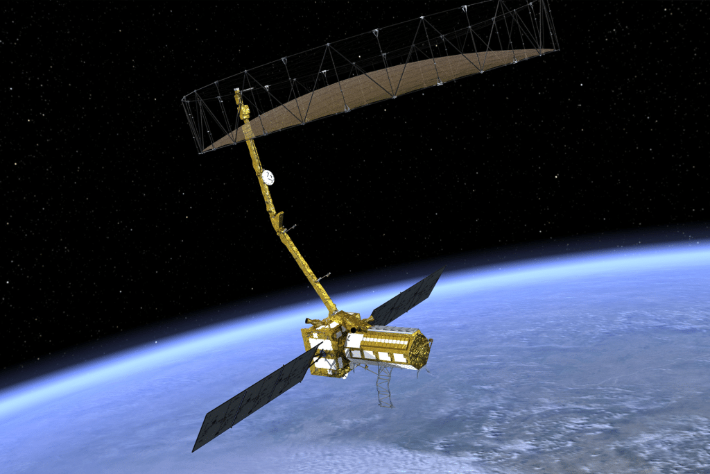
NISAR’s strength lies in its unique combination of two synthetic aperture radar (SAR) systems: an L-band radar, provided by NASA, and an S-band radar, contributed by the Indian Space Research Organisation (ISRO). The L-band penetrates clouds and dense forest canopies, making it ideal for observing hidden terrain, while the S-band excels at detecting lighter vegetation and snow moisture. Together, they allow NISAR to scan nearly all of Earth’s land and ice surfaces every 12 days, producing detailed images with a resolution down to 30 feet.
This dual-radar approach sets NISAR apart from previous NASA missions. By simulating a traditional radar antenna that would need to be 12 miles long for comparable clarity, the 39-foot reflector delivers sharp, actionable data. Scientists can use this to create 3D time-lapse maps, revealing changes in Earth’s surface with precision down to fractions of an inch.

Tracking a Changing Planet
NISAR’s capabilities promise to transform how we understand and respond to Earth’s dynamic systems. The satellite will track glacier and ice sheet movements, offering insights into climate change impacts. It will also monitor land deformations from earthquakes, volcanoes, and landslides, providing critical data for disaster preparedness. Beyond natural phenomena, NISAR will observe changes in forests and wetlands, aiding efforts to protect ecosystems and ensure food security.
For decision-makers, the satellite’s data will inform infrastructure planning, disaster response, and agricultural strategies. Its ability to see through clouds ensures reliable observations regardless of weather, making it a vital tool for global communities facing environmental challenges.
The “Bloom” Process Unveiled
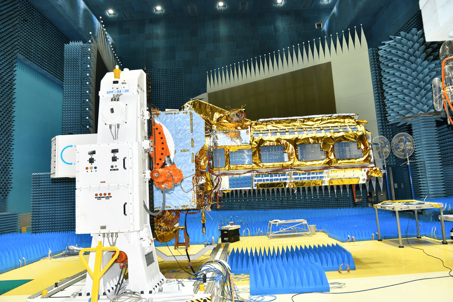
The antenna’s deployment was a carefully orchestrated sequence. Seventeen days after launch, the satellite’s 30-foot boom began unfolding joint by joint over four days. On August 15, small explosive bolts released the stowed reflector, allowing it to unfurl in just 37 minutes. Motors and cables then locked it into its final position, completing the “bloom” that transformed the compact 2-foot package into a 39-foot scientific powerhouse. This process, executed by teams at NASA’s Jet Propulsion Laboratory (JPL) and ISRO, showcased years of engineering precision.
The reflector’s design draws on decades of JPL’s radar expertise, from the 1978 Seasat mission to the 1990s Magellan probe, which mapped Venus. NISAR’s antenna, however, is the largest and most advanced yet, pushing the boundaries of space-based observation.
A Landmark NASA-ISRO Collaboration
NISAR represents a historic partnership between NASA and ISRO, blending technical expertise from both agencies. ISRO’s U R Rao Satellite Centre built the spacecraft, while its Space Applications Centre provided the S-band radar. NASA’s JPL contributed the L-band radar, the antenna reflector, and critical communication systems. The mission’s operations, including the antenna’s deployment, are managed by ISRO’s global telemetry network, with NASA’s Goddard Space Flight Center handling data collection.
This collaboration underscores the power of international cooperation in tackling global challenges. By combining resources, the U.S. and India have created a satellite capable of delivering transformative science, with data expected to flow by late fall.
What’s Next for NISAR
With the antenna now operational, the NISAR team is focused on fine-tuning the satellite’s systems to begin full-scale data collection. The mission’s ability to produce high-resolution, time-lapse imagery will open new avenues for research and practical applications. From improving disaster response to enhancing climate models, NISAR’s data will empower scientists and policymakers to address pressing global issues.
As the satellite scans Earth’s surface, it will build on the legacy of earlier radar missions while setting a new standard for precision and scale. For tech enthusiasts and environmental advocates alike, NISAR’s deployment marks the start of a new era in understanding our planet’s ever-changing landscape.