
Apple Maps is expanding its enhanced mapping features to Kansas City, adding both Look Around and the Detailed City Experience to the region. The update gives residents and visitors access to Apple’s most advanced mapping tools, including immersive street-level imagery and more accurate navigation across downtown streets, neighborhoods and major landmarks.
Kansas City joins a growing list of U.S. metro areas receiving these upgraded views, which are rolling out as Apple continues refining its mapping platform across the country.
Look Around Coverage Expands in the Midwest
Look Around provides interactive, high-resolution street imagery similar to Google Street View but with smoother transitions and improved visual clarity. The feature now spans much of downtown Kansas City, Union Station, the Crossroads district and surrounding areas, offering users an easy way to preview routes, identify storefronts or explore unfamiliar neighborhoods before visiting.
Apple has been steadily adding Look Around to more Midwestern cities, reflecting a broader effort to close coverage gaps between major coastal regions and interior states.
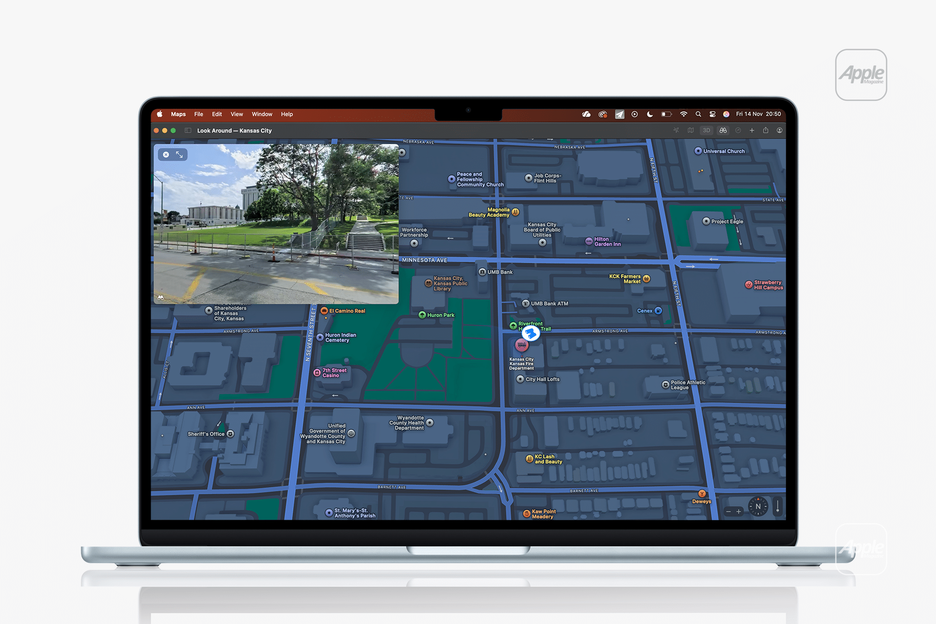
Enhanced Navigation Through the Detailed City Experience
Kansas City also now benefits from the Detailed City Experience, which includes more precise road layouts, better building shapes, improved lane details and enhanced pedestrian pathways. This update makes turn-by-turn navigation more reliable, particularly in dense areas where overlapping roads, ramps and interchanges previously lacked clarity.
The improvements extend to the representation of local landmarks. Buildings around Crown Center, Power & Light District and the River Market area now appear with more accurate proportions and textures, making the map easier to read at a glance.
Transit Support and Local Mobility Features
With this update, public transportation data in Kansas City is easier to follow, with more detailed stop information and clearer walking guidance between stations. The improvements also help cyclists and pedestrians by showing more realistic sidewalk and crosswalk layouts across key neighborhoods.
These enhancements align with Apple’s ongoing effort to refine urban mobility tools in regions that historically received less frequent updates compared with larger metropolitan hubs.
A Steady Expansion of Apple Maps Enhancements
The rollout in Kansas City continues Apple’s U.S. expansion of Look Around and detailed urban mapping, which has accelerated throughout 2024 and 2025. The company has prioritized major commuter corridors and mid-sized cities where updated maps can meaningfully improve daily navigation and tourism planning.
As improvements continue across the Midwest and Great Plains, Apple Maps is closing the feature gap between heavily mapped coastal cities and central regions, bringing a more consistent user experience nationwide.