Apple introduced LiDAR technology to the iPhone Pro lineup to bring high-precision depth sensing into a handheld device. The system uses pulses of light to measure the distance between the phone and surrounding objects, creating an accurate three-dimensional map of the environment in real time. This capability enhances photography, augmented reality, spatial measurement, and professional workflows that previously required specialized scanning hardware.
Unlike traditional camera-based depth detection, LiDAR operates independently of ambient lighting conditions, allowing it to function in dark environments or complex indoor spaces where standard depth estimation struggles.
The result is faster autofocus in low light, improved portrait photography, and a range of creative and technical applications built on spatial awareness.
LiDAR Technology and How It Works
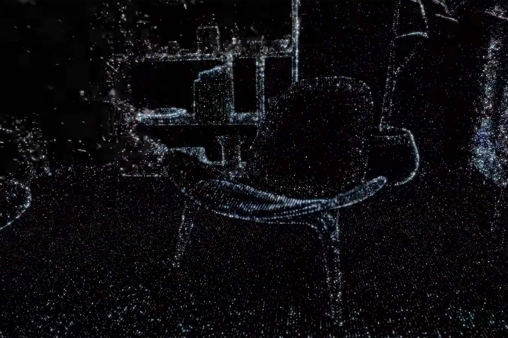
LiDAR stands for Light Detection and Ranging. The sensor emits thousands of invisible infrared pulses per second and measures the time it takes for each pulse to reflect back to the device. By calculating these return times, the system determines distance and builds a depth map of the scene. Combined with the iPhone’s image processing pipeline and ARKit frameworks, this information allows apps to understand surfaces, object shapes, and spatial relationships instantly.
Because the depth map is generated continuously, AR applications can anchor digital objects more accurately to floors, walls, or furniture. Virtual objects remain stable as users move the device, improving realism and enabling professional uses such as digital staging, room planning, and construction visualization.


Architecture, Interior Design, and Spatial Planning
In architecture and interior design workflows, iPhone LiDAR enables rapid room scanning and dimension measurement without tape measures or dedicated scanning equipment. Designers can capture full interior spaces, generate approximate floor plans, and experiment with layout adjustments directly on the device. Furniture placement visualization, lighting simulations, and material previews become faster during early planning stages.
Construction professionals can also document site progress, compare scans over time, and verify measurements when reviewing installations. While large-scale surveying still relies on specialized equipment, mobile LiDAR scanning speeds up preliminary evaluations and field documentation, especially in indoor environments.
Gaming, AR Experiences, and Creative Applications
Game developers and AR creators benefit from LiDAR’s ability to recognize surfaces instantly. Games can place interactive elements realistically across the physical environment, adjusting gameplay based on walls, floors, or obstacles. Educational apps can build immersive simulations using real-world geometry, while creative tools allow artists to capture 3D references for modeling and animation projects.
Photography also gains new capabilities. Depth information improves night-mode portraits, accelerates focus acquisition, and enables more precise subject separation in computational photography workflows. Developers increasingly use LiDAR data to generate 3D assets directly from physical objects, shortening production cycles for visual effects and interactive media.

Everyday Measurement and Utility Uses
Beyond professional scenarios, LiDAR introduces practical daily tools. Measurement apps can estimate height, width, and distance instantly by pointing the camera at an object. Home improvement planning, furniture installation, and room layout adjustments become easier when approximate dimensions are captured quickly without manual measuring tools.
As software continues evolving, LiDAR datasets integrate with cloud-based modeling platforms, enabling captured scans to be exported into design software for refinement. This connection between mobile scanning and professional modeling environments expands the range of tasks handled directly from an iPhone Pro device.
The integration of LiDAR within Apple’s hardware and software ecosystem has transformed the smartphone into a spatial-aware computing platform capable of supporting imaging, mapping, design visualization, augmented reality, and 3D capture workflows that previously required dedicated scanning systems.